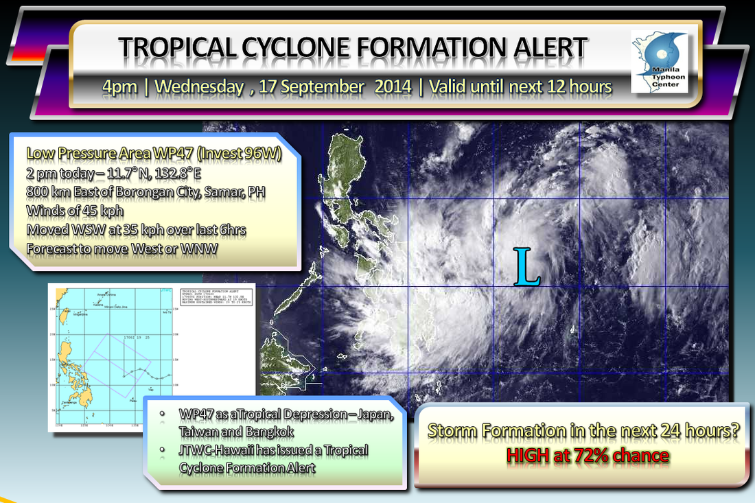
Based on current analysis, the potential of LPA WP47 (Invest 96W) to form into a Tropical Cyclone over the next 24 hours is now HIGH at 70-80% chance. ManilaTC is now issuing a Tropical Cyclone Formation Alert for the Low Pressure Area to the East of the Samar Islands in the Philippine Sea. Meaning that the likelihood of this system to become a Tropical Depression is now possible over the next 24 hours.
At 2pm today, LPA WP47 (Invest 96W) is located 800 km East of Samar, moving to the West-Southwest at 35 kph. Outer rainclouds of this system have begun to affect the Visayas and Mindanao regions. Should PAGASA upgrade this system, it will be locally named as MARIO. Then if it reaches Tropical Storm strength, it will be named internationally as Fung-Wong. This alert will be valid until the next 12 hours, and will be reissued or cancelled or upgraded depending on the status of the system. Please read our disclaimer at http://typhoonmanila.weebly.com/about-mtc.html ManilaTC |
Archives
July 2016
AuthorThis is the official blog page of Manila Typhoon Center. All the latest advisories from ManilaTC will be coursed here should the Facebook page be inaccessible for any reason. Categories
All
|
Manila Typhoon Center - Your online resource for typhoon updates.
 RSS Feed
