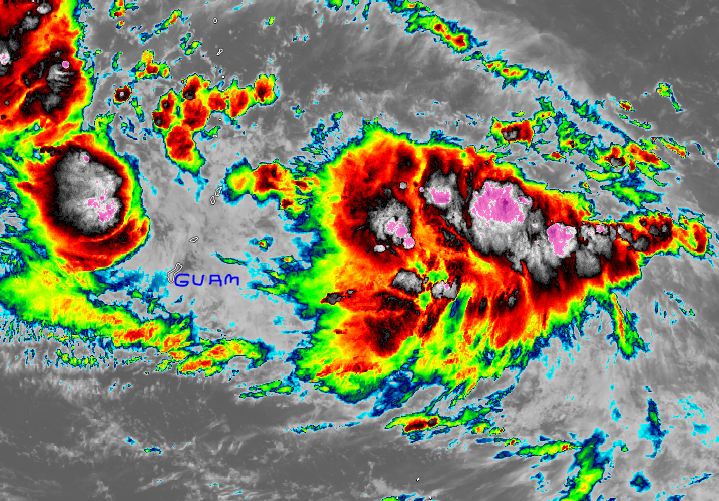
The potential for the development of a significant tropical cyclone within the next 24 hours is upgraded to medium. Invest 91W to have a "Likely " chance of developing into a Tropical Depression within the next 24 hours at 60% The area of convection (Low Pressure Area) being monitored by Manila TC has further organized overnight and is now subject to a Formation Alert, meaning the system could become a Tropical Depression within the next 24 hours.
Invest 91W, now located at 12.5N 153.5E -- 950 km East-Southeast of Guam, has shown further organization overnight. Winds within the LPA are now at 20 Knots (35 KPH). The system is moving West at 18-20 KPH The Joint Typhoon Warning Center has rated Invest 91W as Medium. An upper level low is providing an outflow channel to the system, thus aiding its development, Rainclouds from the system are now causing showers in the Southern Marianas Islands. Forecast Model support is good, with the system tracking over Guam/Marianas Islands in the coming days before making a track through the Philippine Sea. Whether Invest 91W will affect the Philippines remains to be seen as some model runs indicate a recurve towards Japan in the far future, thus long-range track forecasts confidence are very low. |
Archives
July 2016
AuthorThis is the official blog page of Manila Typhoon Center. All the latest advisories from ManilaTC will be coursed here should the Facebook page be inaccessible for any reason. Categories
All
|
Manila Typhoon Center - Your online resource for typhoon updates.

 RSS Feed
