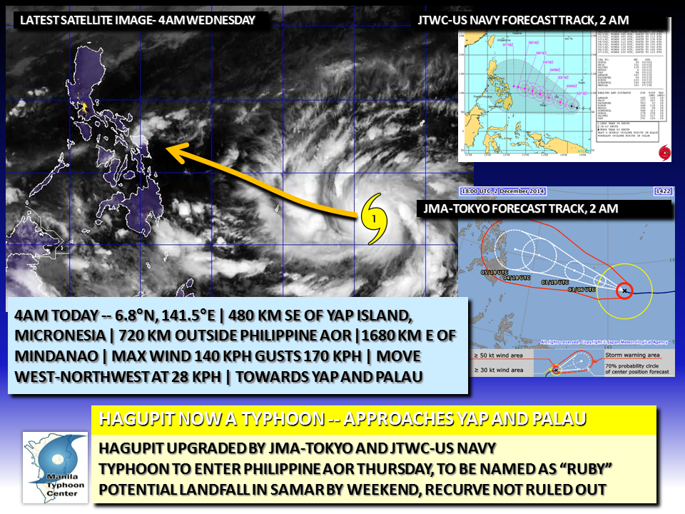
 The US National Weather service has now issued the following warnings for Typhoon Hagupit: Numerous agencies across the Western Pacific have upgraded HAGUPIT into a Typhoon as it intensifies and tracks toward the Palau and Yap Islands.
At 4 am today, ADT fixes Typhoon Hagupit to be about 480 km Southeast of the island of Yap, with maximum center winds of 140 KPH and gusts reaching 170 KPH... Hagupit has begun a steady move to the West-Northwest... Typhoon Hagupit is poised to move south of Yap later today. Typhoon Hagupit is about 720 km outside the Philippine Area of Responsibility, and is predicted to cross the 135E Longitude line by Thursday afternoon/evening. PAGASA shall name Hagupit locally as RUBY once it enters the Philippines AOR. Typhoon Hagupit may reach Super Typhoon status, and that possibility is not out of the question as the Typhoon moves in a favorable environment. Rapid Intensification is expected. Forecast agencies and models are still not discounting the possibility of the Typhoon sparing the Philippines by making a recurve to the north... but still a threat to Southern Luzon, Bicol Region, the Visayas and Northern Mindanao. These areas are advised to keep watch on the progress of Typhoon Hagupit. |
Archives
July 2016
AuthorThis is the official blog page of Manila Typhoon Center. All the latest advisories from ManilaTC will be coursed here should the Facebook page be inaccessible for any reason. Categories
All
|
Manila Typhoon Center - Your online resource for typhoon updates.
 RSS Feed
