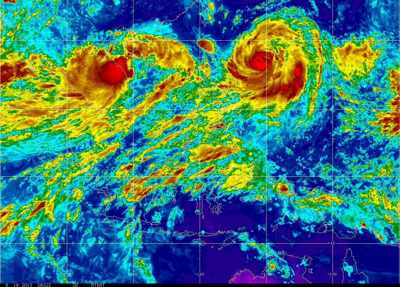
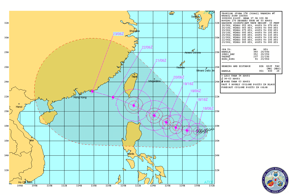
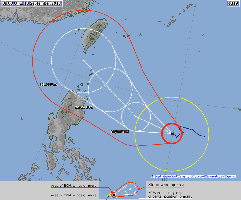
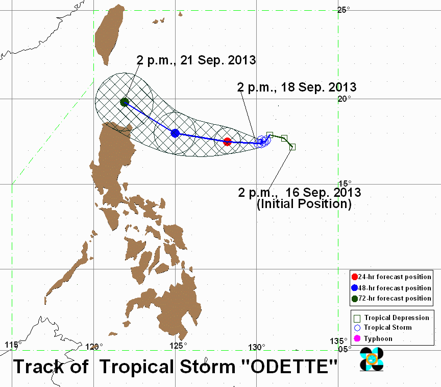
 We now have two tropical cyclones in the Western Pacific, Severe Tropical Storm ODETTE (Usagi) barely moving east of Northern Luzon, and Tropical Depression TC31/18W in the South China Sea. A third disturbance is currently still persisting East of Guam and is also being monitored. More at the jump, so Click Read More :) Severe Tropical Storm ODETTE (Usagi/TC30/17W/1319) ODETTE (Usagi) is now upgraded into a Severe Tropical Storm as it continues to intensify over the Northern Philippine Sea. Due to the nearly stationary nature of ODETTE (Usagi), no storm warnings have been raised by PAGASA as of its 11 am warning. at 5 pm today Manila time, TROPICAL STORM ODETTE (Usagi) was last located at 17.3°N, 129.9°E... about 760 km East-Southeast of Tuguegarao, Cagayan... based on the JMA 5pm warning.... ODETTE (Usagi) has Maximum winds of 105 KPH and gusts reaching 130 KPH, moving WEST/WEST-SOUTHWEST at 7 KPH.
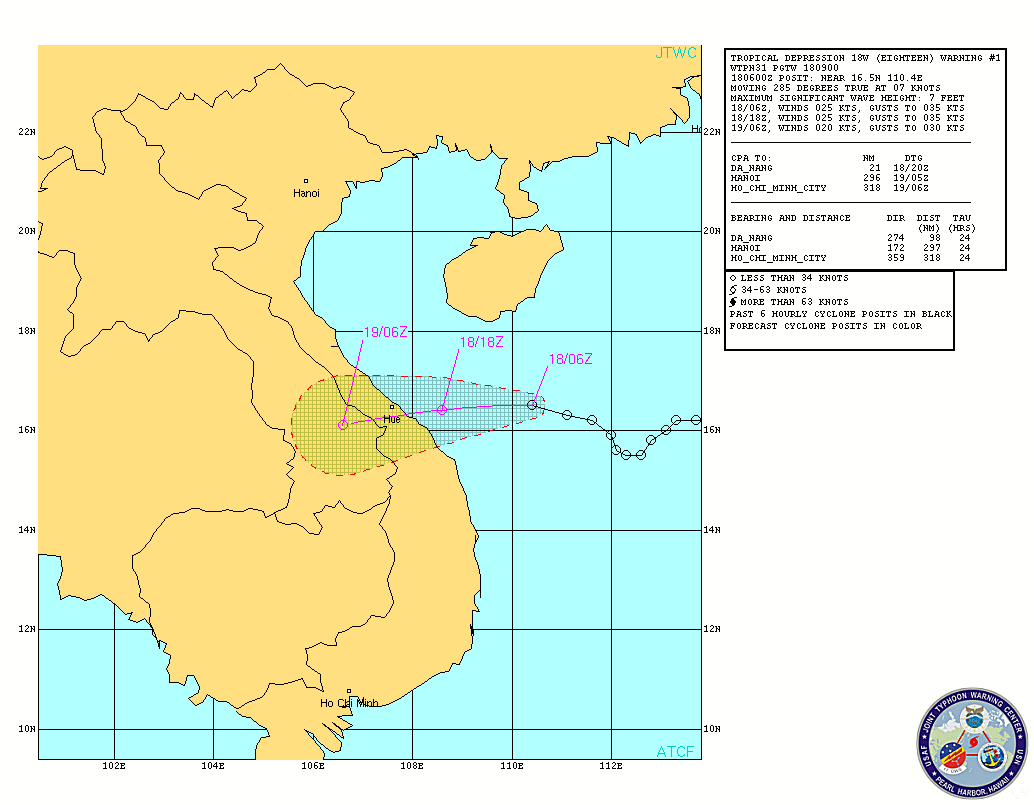
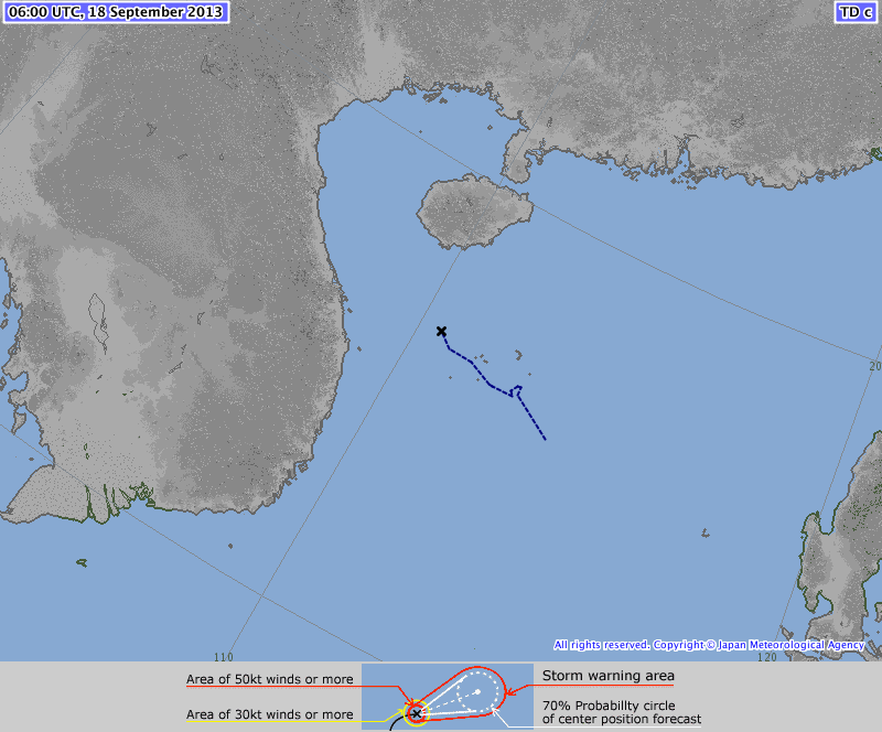
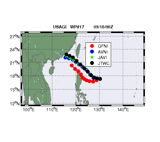 Forecast tracks and Computer models have consistently depicted ODETTE (Usagi) to move West all through out with a turn to the West-Northwest after 48 hours. Currently the consensus is that the brewing howler will pass between Luzon and Taiwan (No sightseeing trips to Batanes please at this time - Ed.) But there is a likelihood as well that the High Pressure Ridge to over Southern China will remain strong and force ODETTE (Usagi) towards Northern Luzon. Furthermore, intensity estimates of ODETTE (Usagi) are expecting for it to reach a strong Category 3 typhoon peaking at 160 to 180 kph range. The Philippine Sea is a region of rapid intensification with the right conditions, it would be no surprise, if ODETTE explodes into a Super Typhoon later on. Tropical Depression 18W The 31st Tropical Cyclone of the 2013 season formed off the west of Vietnam now known as Tropical Depression 18W (TC31). JTWC has just upgraded the area known before as WP73. TC31 is located at 16.5°N, 110.4°E... about 230 km East-Northeast of Da Nang, Vietnam... based on the JTWC 5pm warning.... TC31 has Maximum winds of 45 KPH and gusts reaching 65 KPH, moving WEST/WEST-SOUTHWEST at 13 KPH. TC31 formed too close to land and is expected to make landfall within the next 12-18 hours over Central Vietnam. It is also no longer expected to intensify any further as well.
|
Archives
July 2016
AuthorThis is the official blog page of Manila Typhoon Center. All the latest advisories from ManilaTC will be coursed here should the Facebook page be inaccessible for any reason. Categories
All
|
Manila Typhoon Center - Your online resource for typhoon updates.
 RSS Feed
