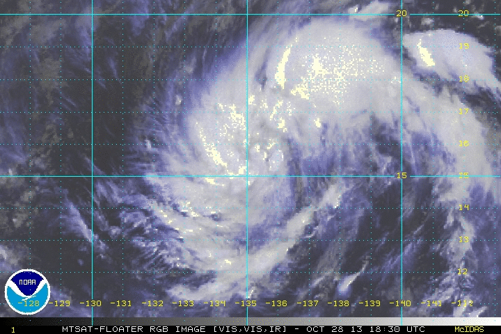
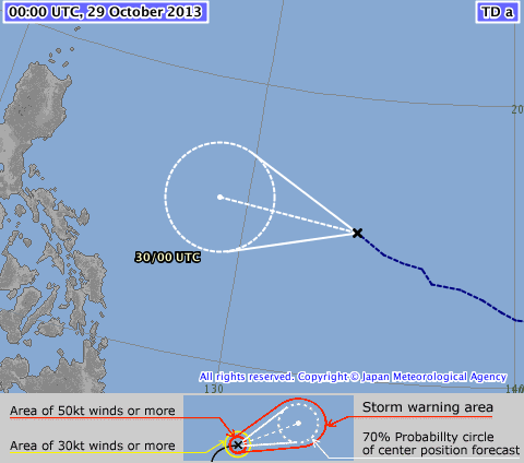
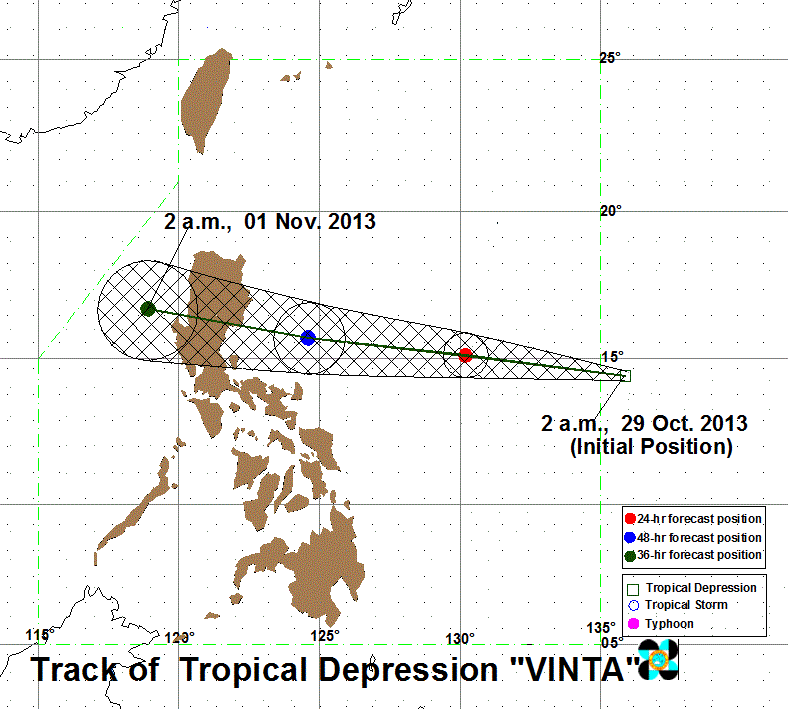
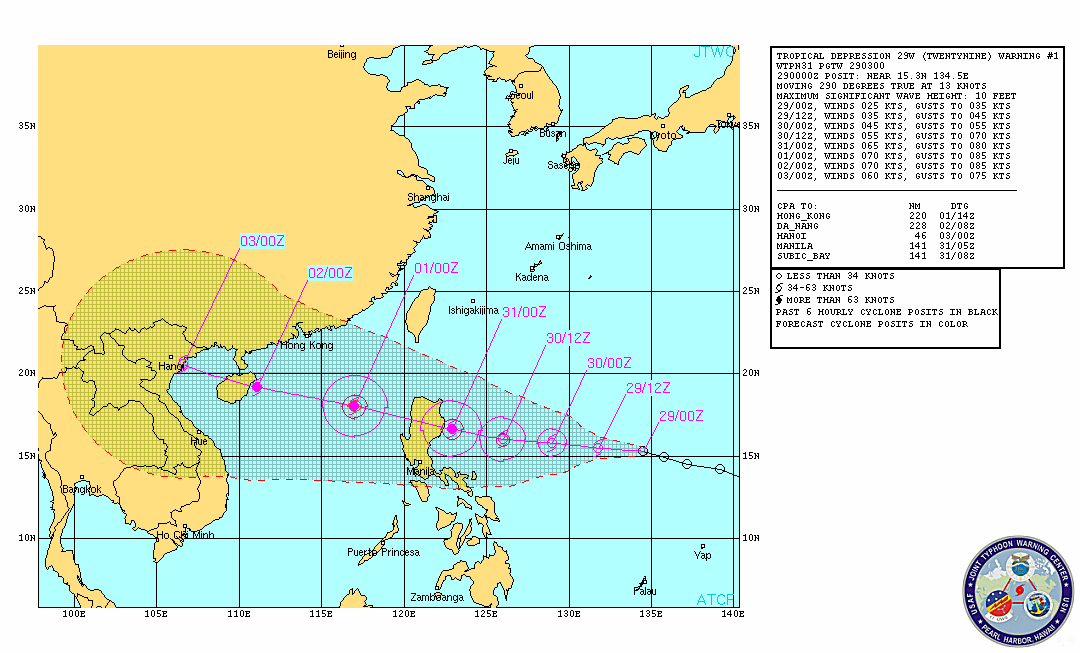
 Click to view Satellite Loop Click to view Satellite Loop Disturbance WP89 (29W) has entered the Philippine Area of Responsibility and at the same time has become the 34th Tropical Cyclone in the Western Pacific as a Tropical Depression. PAGASA-Manila has named the system as VINTA. JMA-Tokyo has been tracking the system since yesterday as well. VINTA is posing a threat to Luzon within the next 3-4 days. NO PAGASA STORM SIGNALS HAVE BEEN RAISED AT THIS TIME. At 8 am today (00Z), the center of TROPICAL DEPRESSION VINTA (TC34) has been located at 15.1°N, 134.2°E, about 1,360 kms East-Southeast of Baler, Aurora or 1,320 kms East-Northeast of Polilio Island in Quezon Province... with Maximum Sustained Winds of 55 KPH (30 Knots) and gusts of 70 KPH (40 Knots)... VINTA (TC34) is currently moving to the WEST at 30 KPH in the general direction of Eastern Luzon... and is expected to become a Tropical Storm within the next 24 hours. Current model tracks depict the storm to track West all throughout the forecast period, towards Eastern Luzon. Residents and Interests on Luzon island should keep watch on the path of this storm, especially those preparing to travel for the All Saints/All Souls day holiday this weekend. ManilaTC
|
Archives
July 2016
AuthorThis is the official blog page of Manila Typhoon Center. All the latest advisories from ManilaTC will be coursed here should the Facebook page be inaccessible for any reason. Categories
All
|
Manila Typhoon Center - Your online resource for typhoon updates.
 RSS Feed
