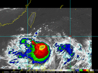
 Tropical Storm NANDO (KONG-REY) resumed its expected North-Northwest track after briefly moving to the Northwest yesterday, prompting PAGASA to raise storm warnings across some provinces in Northern Luzon... It is now more of a threat now to the Okinawa/Ryukyu Islands region Meanwhile, a new Tropical Disturbance has formed in the West Philippine Sea, west of Metro Manila at this time. More information at the jump regarding the two tropical systems and the Southwest Monsoon... So click Read More :) Tropical Storm NANDO (KONG-REY)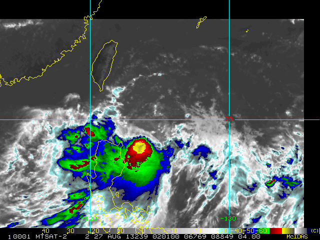 NANDO (KONG-REY) has moved North-Northwest in a track towards the Batanes-Taiwan area. PAGASA STORM WARNINGS Signal Number 2 meaning 61 to 100 kph winds within 24 hours -- Batanes Group of Islands... Signal Number 1 meaning 45 to 60 kph winds within 36 hours -- Cagayan, Calayan and Babuyan Group of Islands, Apayao, Isabela At 5am today, the center of NANDO (KONG-REY) was located at 18.0°N, 123.7°E... about 220 km East-Southeast of Aparri, Cagayan, Philippines... Maximum winds at 65 kph, gusting up to 80 kph... a minimal Tropical Storm. A Gale Warning is also in force over The eastern seaboards of Central and Southern Luzon (Aurora, Camarines Provinces, Catanduanes, the Eastern coasts of Albay, Sorsogon, Quezon Province including Polillo Island)... meaning winds of 52 to 64 kph are to be experienced with rough seas of 3m to 4.5m (10-15 feet) PAGASA estimates of rainfall amount is from 10 - 25 mm per hour (heavy - intenese) within the 400 km diameter of the Tropical Storm... Forecast tracks of asian weather agencies are in good agreement bringing NANDO (KONG-REY) into the North-Northwest in response to a trough (low) located over East China, tracking east towards Japan... causing the Western Pacific ocean high to allow NANDO (KONG-REY) to track towards Japan. Tropical Disturbance WP55 (Invest 92W)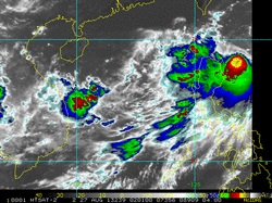 A new tropical disturbance has formed West of Luzon over the West Philippine Sea, within the monsoon trough. At 2am Manila, WP55 (92W) was located at 14.9°N, 114.1°E... about 740 km West of Metro Manila... Winds of 25kph have been found within the disturbance... WP55 (92W) tracked to the Northeast at 10kph towards Northern Luzon. The potential of WP55 (92W) for its development into a Tropical Cyclone within the next 24 hours is FAIR, but now with 38% chance. The Influence of the 2 systems with the Southwest Monsoon (Habagat)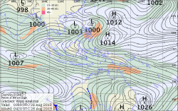 This streamline analysis (surface windflow chart) from BoM-Australia shows that the SW Monsoon is more stronger in the Visayas and Mindanao areas as shown by the orange colors.
As TS Nando (Kong-rey) gains further latitude, the Monsoon will follow and start to affect Western Luzon again once it reaches east of Batanes/Taiwan. Disturbance WP55's influence is minimal as it is embedded within the monsoon flow itself, and may be dragged to the Northeast by Nando. |
Archives
July 2016
AuthorThis is the official blog page of Manila Typhoon Center. All the latest advisories from ManilaTC will be coursed here should the Facebook page be inaccessible for any reason. Categories
All
|
Manila Typhoon Center - Your online resource for typhoon updates.
 RSS Feed
