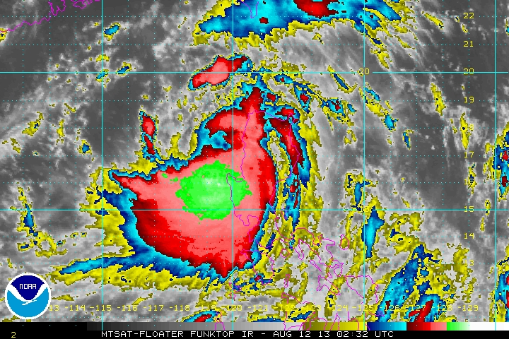
 Powerful Typhoon LABUYO (UTOR) made landfall between 3 am and 4 am this morning as a Category 3 Typhoon, after briefly becoming a SUPERTYPHOON before midnight last night. The clear eye filled a few hours before landfall near Casiguran, Aurora. The typhoon passed Quirino, Mt. Province, Benguet and Baguio City and La Union province. As of 11 am, LABUYO (UTOR) is just off the coast of Candon City, Ilocos Sur as it emerges into the South China Sea. Maximum winds have weakened to 140 kph, still a Category 1 Typhoon as it tracks to the WEST NORTHWEST at 25 kph. PAGASA TYPHOON WARNING SIGNALS AS OF 11 AM TODAY SIGNAL 3 -- Quirino, Nueva Vizcaya, Ifugao, Mt. Province, Ilocos Sur, Benguet, La Union, Pangasinan SIGNAL 2 -- Isabela, Aurora, Southern Cagayan, Kalinga, Abra, Southern Ilocos Norte, Zambales, Tarlac and Nueva Ecija SIGNAL 1 -- Rest of Cagayan, Apayao, Rest of Ilocos Norte, Babuyan Group, Calayan Group, Pampanga, Bulacan, Bataan, Rizal, Northern Quezon, Polillo Island, and Metro Manila. Public Storm Warning signals elsewhere have been lowered.
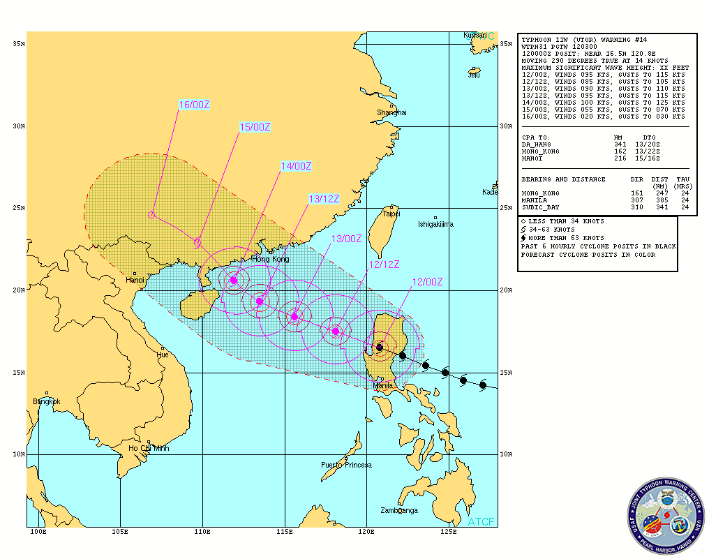
Regarding LABUYO's future track, residents of Guangdong province in Southern China should keep track as both the JMA and JTWC's forecast track send the Typhoon towards your direction in a couple of days tops.
LABUYO is enhancing the Southwest Monsoon as we speak, bringing heavy rain across Pangasinan, Zambales and Bataan. #ManilaTC #StormWatch #BantayBagyo #HabagatWatch #TyphoonWatch #LabuyoPH #UtorWP |
Archives
July 2016
AuthorThis is the official blog page of Manila Typhoon Center. All the latest advisories from ManilaTC will be coursed here should the Facebook page be inaccessible for any reason. Categories
All
|
Manila Typhoon Center - Your online resource for typhoon updates.

 RSS Feed
