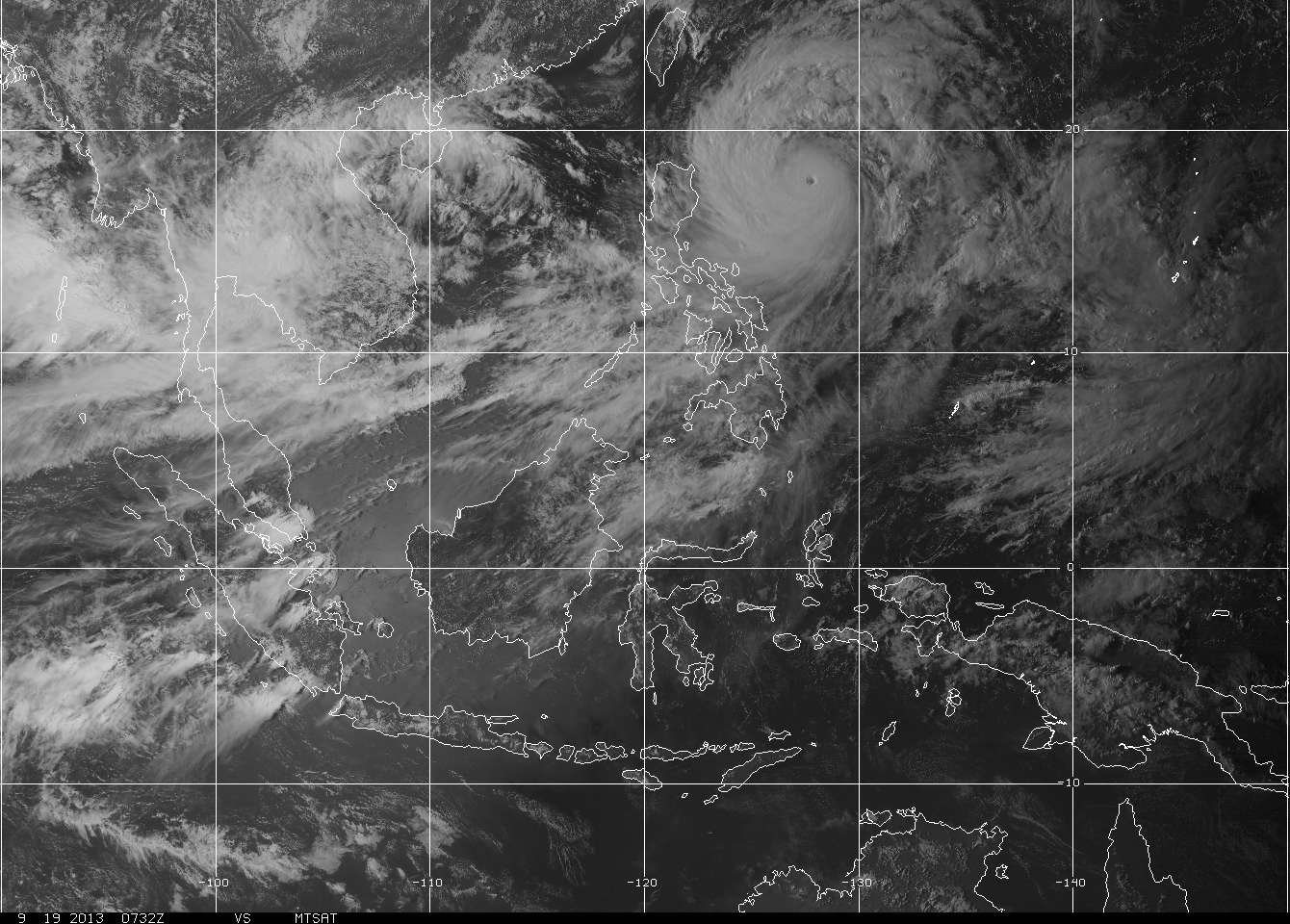
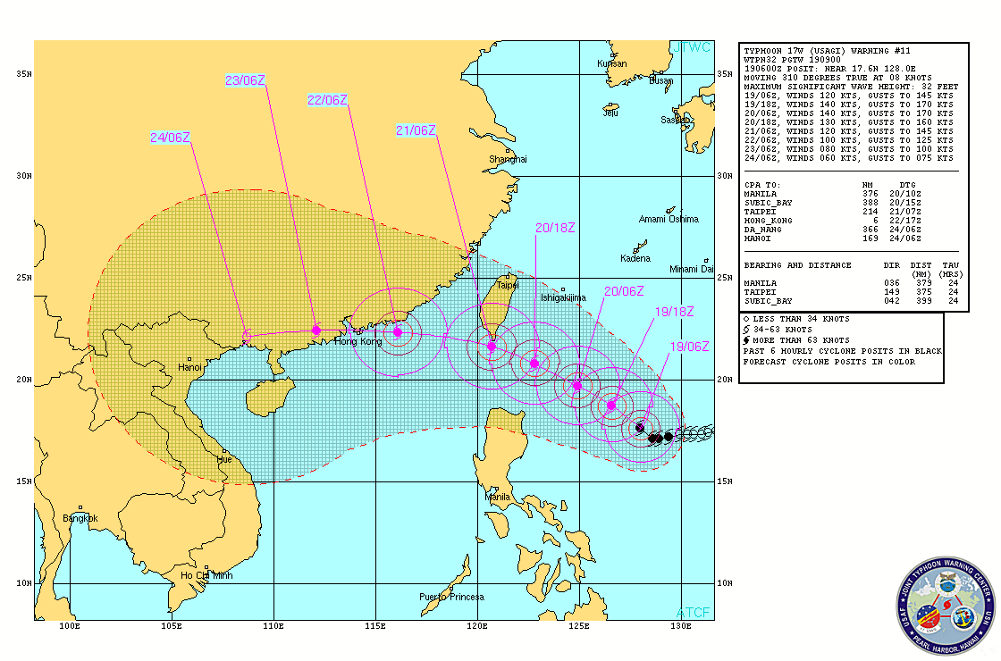
 Time and time again, the waters of the Philippine Sea have generated several major Typhoons due to its warm Sea Surface Temperatures (SST's). Looks like ODETTE (Usagi) will be no exception. More at the jump. Click "Read More"...  ODETTE (Usagi) upgraded into a Typhoon this morning, has exploded into a howler. Now nearing Super Typhoon status, ODETTE (Usagi) is now a powerful Category 3 Storm. PAGASA TYPHOON WARNING SIGNALS (as of 5pm Warning) SIGNAL NUMBER 2 -- Batanes Group of Islands, Cagayan, Calayan and Babuyan Group of Islands, Apayao... meaning winds of 61-100 kph are expected in the next 24 hours SIGNAL NUMBER 1 -- Ilocos Norte, Ilocos Sur, Mt. Province, Ifugao, Abra, Kalinga, Isabela ... meaning winds of 45-60 kph are expected in the next 36 hours At 5 pm today Manila time, The eye of TYPHOON ODETTE (Usagi) was last located at 17.9°N, 127.7°E... about 640 km East-Southeast of Aparri, Cagayan or 630 km East of Tuguegarao, Cagayan... fix based on the ADT fixes... ODETTE (Usagi) jogged to the North-Northwest for a moment and latest Satellite loops indicate that it has resumed its WEST to WEST-NORTHWEST TRACK at a much faster 15 kph. INTENSITY ESTIMATES BY WEATHER AGENCIES PAGASA-Manila -- Max 160 kph Gust 195 kph (10min-average) CMA-Beijing -- Max 160 kph Gust 195 kph (10min-average) JMA-Tokyo -- Max 175 kph Gust 250 kph (10min-average) KMA-Seoul -- Max 170 kph (10min-average) JTWC-Hawaii -- Max 220 kph Gust 270 kph (1min-average) CWB-Taiwan -- Max 170 kph Gust 210 kph (10min-average) Click on the links here for awesome satellite loops on Typhoon ODETTE.
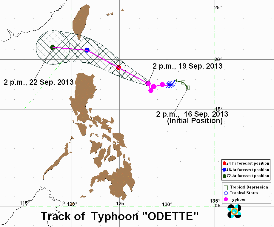
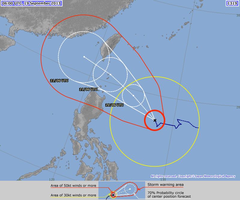
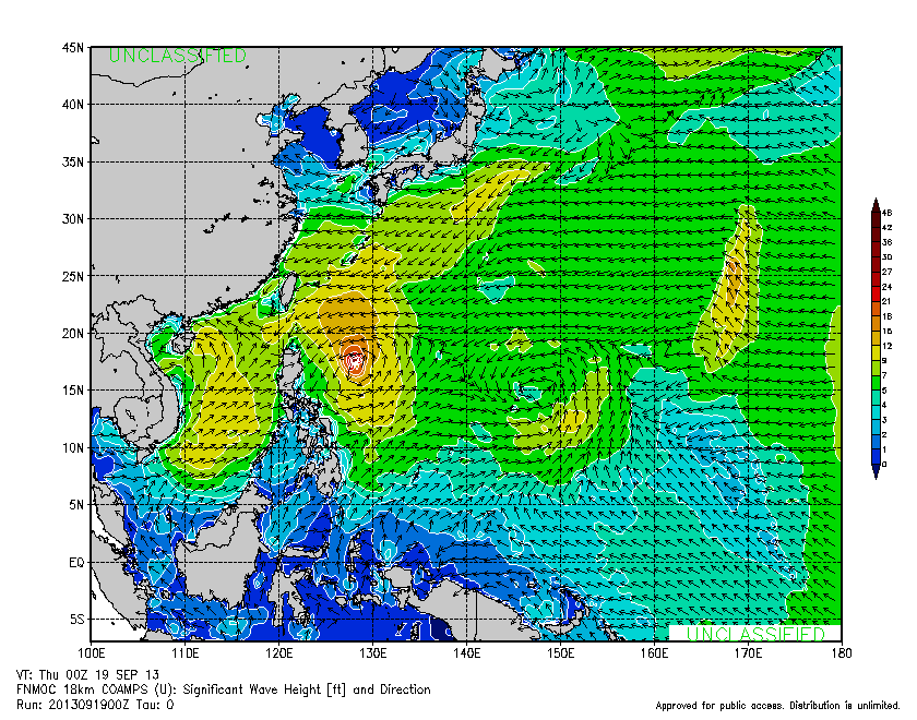
 Now that ODETTE (Usagi) has started moving, forecast tracks and computer models are now in good agreement on tracking the typhoon towards the Batanes-Taiwan Area. Interestingly, ODETTE is now forecast to hit HONG KONG in 3 days as a Category 3 or 4 monster. The typhoon is expected to intensify further, becoming a Category 5 SUPER TYPHOON by JTWC within the next 12 hours having winds of 260kph (1min-average); and JMA-Tokyo ramping it up to 195kph (10min-average). Note the huge size of the Typhoon, with JMA-Tokyo estimating that the diameter of gale force winds (up to 60 kph) is 1000 km! PAGASA-Manila has raised a GALE WARNING as well over the eastern seaboard of Central and Southern Luzon (Aurora, Camarines Provinces, Catanduanes, Eastern coast of Albay, Eastern coast of Sorsogon and Eastern coast of Quezon including Polillo Island); The eastern seaboard of Visayas (Samar and Leyte); and The seaboards of Occidental Mindoro and Palawan. Also, rainfall estimates of the typhoon is 10-20 mm per hour (heavy to intense). Maximum wave height is 32 feet. The SOUTHWEST MONSOON, is expected to ramp up over the weekend over western luzon as ODETTE moves closer.
|
Archives
July 2016
AuthorThis is the official blog page of Manila Typhoon Center. All the latest advisories from ManilaTC will be coursed here should the Facebook page be inaccessible for any reason. Categories
All
|
Manila Typhoon Center - Your online resource for typhoon updates.
 RSS Feed
