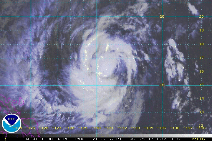
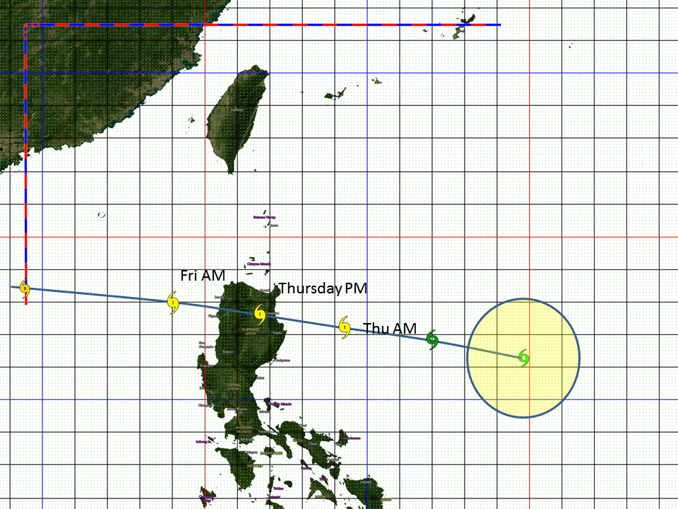
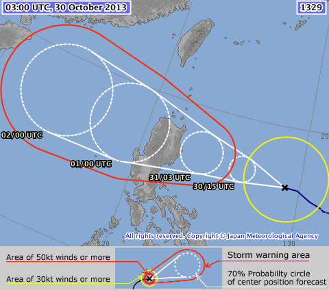
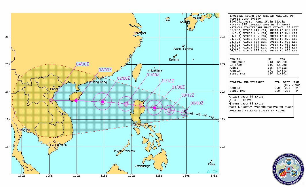
 Click to view loop Click to view loop VINTA has been upgraded into a TROPICAL STORM before dawn, continues to intensify and has shown more development overnight... VINTA (KROSA)'s threat to Northern Luzon increases as storm warnings are raised in more areas. PAGASA STORM WARNING SIGNALS AS OF 11 AM WARNING ----------------------------------------------- STORM SIGNAL #1 -- Cagayan, Calayan Group of Islands, Babuyan Group of Islands, Apayao, Kalinga, Mt. Province, Benguet, Ifugao, Isabela, Aurora, Nueva Vizcaya, Quirino, and Nueva Ecija... winds of 45-60 kph expected within 36 hours. At 11 am today (03Z), the center of TROPICAL STORM VINTA (KROSA) [TC34/29W/1329] has been located at 16.5°N, 129.1°E, about 795 kms East-Southeast of Tuguegarao, Cagayan or 750 kms East-Northeast of Casiguran, Aurora... Maximum Winds of 75 KPH (40 Knots) and gusts of 90 KPH (50 Knots)... VINTA (TC34) is currently moving to the WEST at 24 KPH in the general direction of Northeastern Luzon particularly the Cagayan-Isabela area... VINTA (KROSA) and may reach TYPHOON status before landfall by Tomorrow afternoon or Friday morning. Model forecasts are in good agreement to track VINTA (Krosa) across Northern Luzon rather quickly, then to exit across the Ilocos Region by Friday afternoon. All concerned should follow or track the severe weather potential of the storm not just the track of the storm center. Please take note that any shift in the movement of VINTA (Krosa) to the north or south of the forecast track can make a HUGE difference on the storm's potential effects in your area. Residents and Interests on Luzon island should keep watch on the path of this storm, especially those preparing to travel for the All Saints/All Souls day holiday this weekend. ManilaTC Forecast Tracks (click to enlarge)
|
Archives
July 2016
AuthorThis is the official blog page of Manila Typhoon Center. All the latest advisories from ManilaTC will be coursed here should the Facebook page be inaccessible for any reason. Categories
All
|
Manila Typhoon Center - Your online resource for typhoon updates.

 RSS Feed
