The potential of Disturbance WP04 to develop into a Tropical Cyclone within the next 24 hours has been DOWNGRADED TO FAIR with 40% probability. 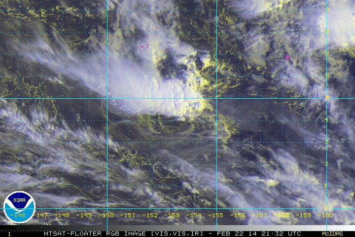 Click to enlarge Click to enlarge The Low Pressure Area WP04 (93W) in the vicinity of Chuuk has remained disorganized over the last 24 hours. WP04 (93W) is struggling to keep intact in the midst of high vertical wind shear over that area.
At 8 am today, the circulation center of WP04 (93W) was located at 4.1°N, 153.2°E, about 390 km South-Southeast of Chuuk Island or 1390 km Southeast of Guam... with 15kt (25kph) winds within the system, WP04 (93W) has remained stationary. Computer models have depicted the system to strengthen and track more towards Guam and the Marianas Islands later next week as a weak tropical depression or storm. Given the long range nature of the forecast and how the models initialize the system, this forecast remains uncertain. ManilaTC 1pm - 23 February |
Archives
July 2016
AuthorThis is the official blog page of Manila Typhoon Center. All the latest advisories from ManilaTC will be coursed here should the Facebook page be inaccessible for any reason. Categories
All
|
Manila Typhoon Center - Your online resource for typhoon updates.
 RSS Feed
