Its June again and along with it comes the start of the wet months, the onset of the Southwest monsoon, and the peak months of the Typhoon Season. PAGASA has dropped hints that they will declare its onset in a matter of days.
Manila TC brings you a primer on what will be in store for the year's wet and rainy season.
Manila TC brings you a primer on what will be in store for the year's wet and rainy season.
EL NINO OR BUST?
 Click to enlarge
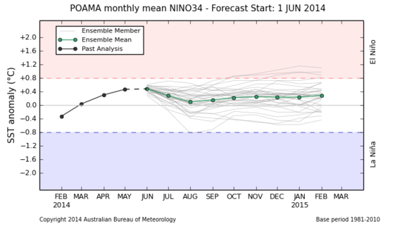
Based on the last update by the Bureau of Meteorology of Australia regarding the state of the Pacific and Indian Oceans last Tuesday, June 3, the Tropical Pacific Ocean remains on track for El Niño in 2014.
The tropical Pacific Ocean remains on track for El Niño in 2014, with just over half of the climate models surveyed by the Bureau suggesting El Niño will become established by August. An El Niño ALERT remains in place, indicating at least a 70% chance of an El Niño developing in 2014.
But wait, according to the latest El Niño forecast models, several climate models have BACKED OFF from the EL NINO scenario...
As per BOM-Australia: Most international climate models surveyed by the Bureau indicate that SSTs in the equatorial Pacific Ocean are likely to continue to warm during winter. Several of the surveyed climate models have eased their predictions slightly since the last update but around half continue to indicate that the equatorial Pacific is likely to exceed El Niño thresholds before or during the southern hemisphere spring.
Is there gonna be an El Niño or not? Lets keep watch.
For the detailed report from the Bureau of Meteorology of Australia, click here.
RAINFALL FORECASTS
 Click to enlarge
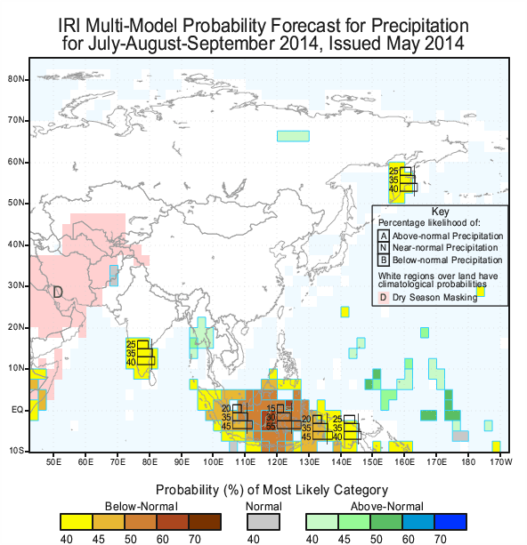
Columbia University's International Research Institute for Climate and Society has indicated a normal rainfall scenario for the Philippines for the months of July, August and September.
Going into the fall months of September-October-November, the IRICS has indicated that areas in Mindanao and Palawan have 25-40% Probability of below normal average rainfall. Given that the El Nino may not occur, these may even be generous.
Looks like normal rains for us here in the metro this year.
TROPICAL CYCLONE FORECAST

The year's storms as of June 6
|
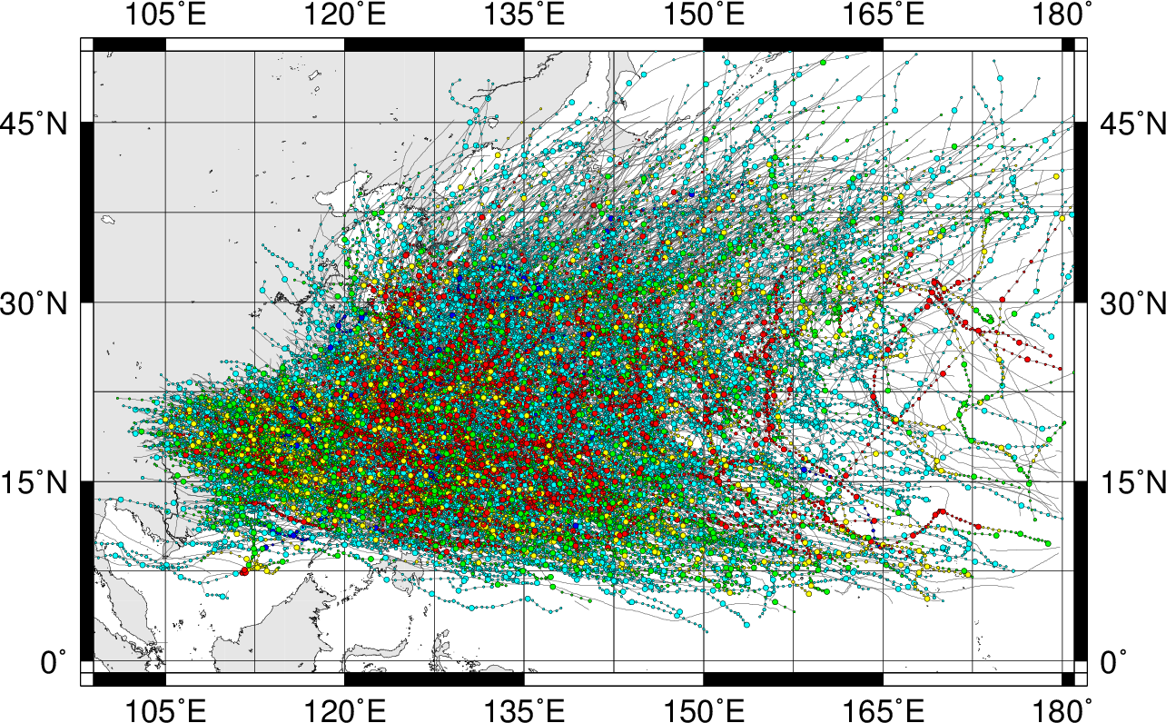
Storm Tracks 1951-2014 with dates of June 1 to December 31.
|
Unless you were living in Mars or in hibernation, it pays to know that we already had 10 tropical cyclones form in the Western Pacific this year.
At least ONE storm formed per month except in May. 5 of them became Named Tropical Storms and 2 of them became Typhoons, according to JTWC-Hawaii... JMA-Tokyo says only one became a Typhoon.
Tropical Storm Risk, a private climate firm, issued this prediction for 2014 last May 6th:
TSR predicts the 2014 Northwest Pacific typhoon season will be the most active since 2004, with activity approximately 25% above the 1965-2013 climate norm.
TSR predicts that 27 tropical storms will form, 17 of which will become Typhoons, 11 becoming intense. Better get those typhoon preparedness kits in motion as we may get a lot this year!
For more information about the TSR forecasts and their verifications for Northwest Pacific typhoon activity please see: http://www.tropicalstormrisk.com/for_typh.html. The next TSR forecast update for the 2014 Northwest Pacific typhoon season will be issued on the 7th July 2014.
