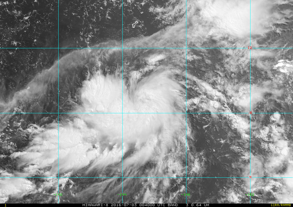
 Himawari-8 image of Tropical Storm Nepartak this morning.
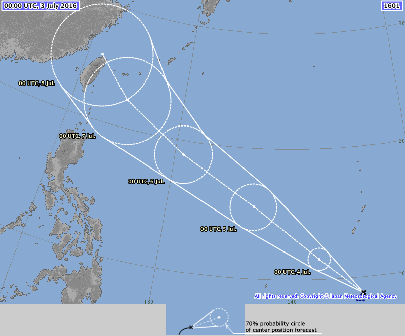
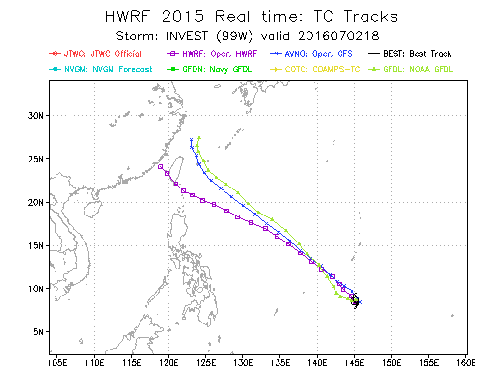
The Tropical Depression located South of Guam has intensfied into a Tropical Storm and named by the Japan Meteorological Agency (JMA) as NEPARTAK(02W). NEPARTAK is the first Tropical Storm of 2016, and breaks a 6-month streak of not having a Tropical Storm form in the WestPac and the 2nd most latest date of a named Tropical Storm, the year 1998 being the first. JMA is the designated Regional Specialized Meteorological Centre for the Western Pacific by the World Meteorological Organization. NEPARTAK NEPARTAK was last spotted at 8.7N 145.1E, about 530 km South of Guam... 770 km East of Yap State... 1110 km East of Philippines AoR. NEPARTAK has winds of 65kph near the center and gusts reaching 80 kph. The storm is forecast to move Northwest slow at first then gradually accelerate. JMA forecasts NEPARTAK(02W) to become a typhoon in about 72 hours. Initial forecast tracks and computer models show Storm NEPARTAK to move Northwest all throughout, bringing a possible threat to Taiwan and the Japanese Ryukyu Islands by weekend. It shall also enter the Philippines AoR by Tuesday. The storm wil be named by PAGASA as BUTCHOY once the storm does cross the 135E meridian. TS NEPARTAK(02W) will bring showers across Yap State and Palau due to the effect of converging monsoonal winds by tomorrow. No direct effects to the Philippines are expected based on track forecasts but its possible that NEPARTAK can bring monsoonal rains to the Philippines' western seaboard before the weekend as the storm makes its closest approach to Northern Luzon. Interests across Taiwan and the Japanese Ryukyu Islands should monitor the progress of NEPARTAK. ManilaTC |
Archives
September 2016
Categories |
Manila Typhoon Center - Your online resource for typhoon updates.
 RSS Feed
