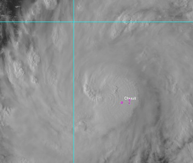
  Typhoon Maysak as it passed Chuuk Atoll Sunday Morning. Typhoon Maysak as it passed Chuuk Atoll Sunday Morning. Intensifying Typhoon Maysak passed the Chuuk atoll/islands this morning, bringing heavy rain and wind to the island. Wind gusts of 111 kph were registered on Weno Airport before conking out in the storm. As of this time, we have not received any damage reports on the island.
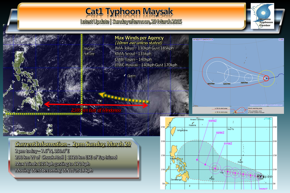
Maysak is now the third Typhoon of the 2015 season, packing winds of 135 kph, moving West at a speed of 18 kph, away from Chuuk and moving towards Yap. It is forecast to move more to the West-Northwest and pass close if not directly hit Yap Island by Tuesday evening. Maysak is also forecast to cross the 135E Philippine AoR line by Wednesday and to be locally named as Chedeng Yap State in Micronesia, should begin to experience the outer bands of the storm by Monday night with worsening conditions as Typhoon Maysak approaches. The JTWC-US Navy expects Maysak to peak at 120 kts (1-min average) or 220 kph, JMA-Tokyo forecasts the typhoon at 175 kph (10-min average) -- both by Wednesday afternoon. Typhoon Watches and Warnings have been issued for islands in Yap and Chuuk States in Micronesia. Kindly refer to their official warnings. Residents in the Philippines should keep watch regarding the progress and track of this storm as there is an increasing likelihood that it may affect your plans for the Holy Week holiday break. ManilaTC |
Archives
September 2016
Categories |
Manila Typhoon Center - Your online resource for typhoon updates.
 RSS Feed
