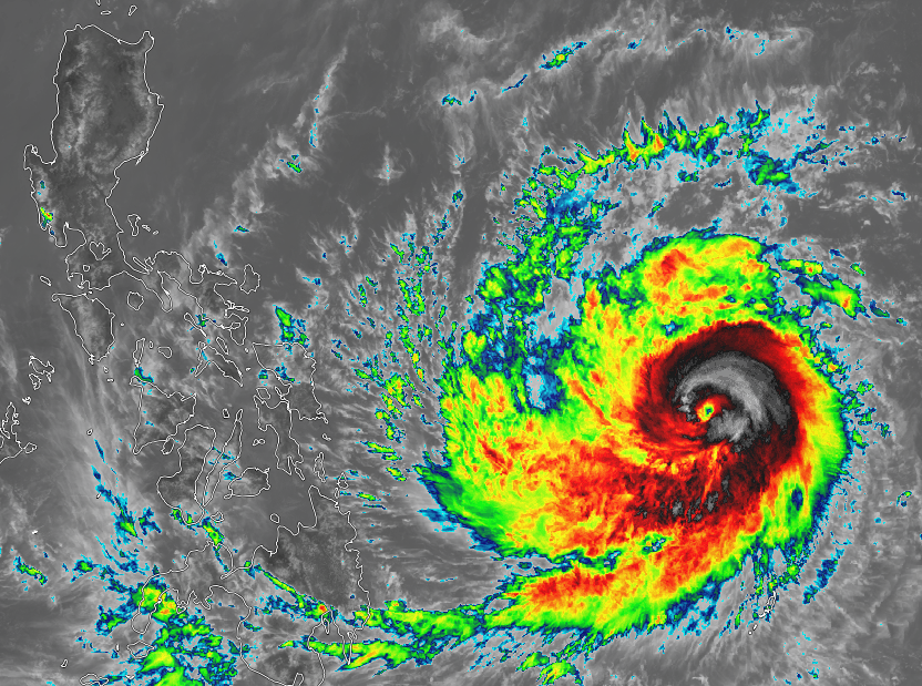
 Typhoon DODONG (NOUL) as it lurks east of Samar, Philippines (Image courtesy of SSEC - Himawari 8) All eyes are now on the course of Typhoon DODONG (Noul), after it crossed the Philippine AoR this Morning. DODONG(Noul) is now a Category 2 Strong Typhoon, packing winds of 145 kph (10-min) to 165 kph (1-min) sustained with gusts reaching 185 kph... DODONG (Noul) has tracked to the West-Northwest
No Public Storm Warnings have been raised yet by PAGASA as of the latest bulletin released at 11 am today, but the agency hinted that this typhoon is expected to initially affect the Eastern Visayas and Bicol region within the next 24 – 36 hours. Available forecast tracks from agencies within the region are now projecting more of a Central Luzon landfall by weekend, possibly by Sunday. This as Computer model forecasts have been trending more west of the initially forecasted track, hinting of a much stronger-than-expected SubTropical Ridge (High) to the north of the typhoon. Typhoon DODONG (Noul) is expected to intensify further as it makes its way across the Philippine Sea towards Luzon, potential rapid intensification is not ruled out. Residents from Eastern Visayas, Bicol Region, Southern Luzon, Metro Manila, Central Luzon and Northern Luzon are advised to take initial precautions and prepare for possible further preparations later on. ManilaTC Typhoon Noul enters Philippine AoR, named as Dodong |
Archives
September 2016
Categories |
Manila Typhoon Center - Your online resource for typhoon updates.
 RSS Feed
