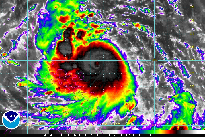
SYNOPSIS Dangerous and Intensifying Category 2 Typhoon LABUYO (UTOR) continues to tread closer to Eastern Luzon... Posing an increasing threat to Luzon. Interests in LUZON should closely monitor the progress of this Typhoon. Areas under the storm warnings should follow or track the severe weather potential of the storm not just the storm center. Severe weather meaning: Torrential Rainfall, Storm Surges and the potential of flooding and landslides... SUMMARY | At 1000AM Manila 0200z
AGENCY WARNINGS | PAGASA STORM WARNINGS Based on 11 am warning SIGNAL NUMBER 3 (100 to 185 kph within 18-24 hours) - Catanduanes, Camarines Provinces, Northern Quezon Province including Polilio Island, Aurora, Isabela SIGNAL NUMBER 2 (61 to 100 kph within 24 hours) - Albay, Sorsogon, Rizal, Rest of Quezon, Laguna, Bulacan, Nueva Ecija, Quirino, Nueva Viscaya, Benguet, Ifugao, Mountain Province, Kalinga, Cagayan SIGNAL NUMBER 1 (45 to 60 kph within 36 hours) - Cagayan, Calayan Group of Islands, Babuyan Group of Islands, Ilocos Norte, Ilocos Sur, Apayao, Abra, La Union, Pangasinan, Tarlac, Zambales, Pampanga, Bataan, Cavite, Batangas, Marinduque, Burias and Ticao Islands, Metro Manila #ManilaTC #StormWatch #BantayBagyo #HabagatWatch #TyphoonWatch #IsangPH
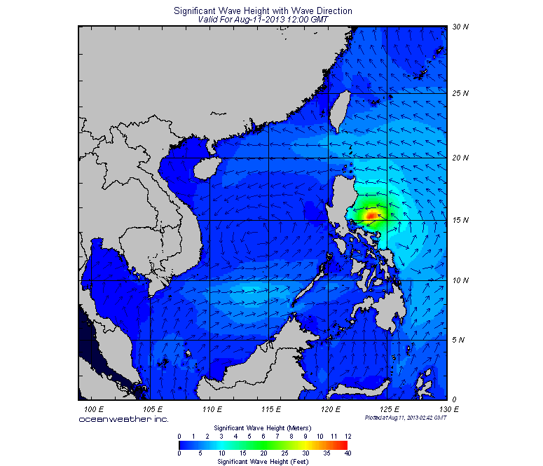
STORM HAZARDS
NOTES:
|
Archives
July 2016
AuthorThis is the official blog page of Manila Typhoon Center. All the latest advisories from ManilaTC will be coursed here should the Facebook page be inaccessible for any reason. Categories
All
|
Manila Typhoon Center - Your online resource for typhoon updates.


 RSS Feed
