The potential of Disturbance WP04 to develop into a Tropical Cyclone within the next 24 hours has been DOWNGRADED TO FAIR with 40% probability.  Click to enlarge Click to enlarge The Low Pressure Area WP04 (93W) in the vicinity of Chuuk has remained disorganized over the last 24 hours. WP04 (93W) is struggling to keep intact in the midst of high vertical wind shear over that area.
At 8 am today, the circulation center of WP04 (93W) was located at 4.1°N, 153.2°E, about 390 km South-Southeast of Chuuk Island or 1390 km Southeast of Guam... with 15kt (25kph) winds within the system, WP04 (93W) has remained stationary. Computer models have depicted the system to strengthen and track more towards Guam and the Marianas Islands later next week as a weak tropical depression or storm. Given the long range nature of the forecast and how the models initialize the system, this forecast remains uncertain. ManilaTC 1pm - 23 February The potential of Disturbance WP04 to develop into a Tropical Cyclone within the next 24 hours remains at MEDIUM with 50% probability. 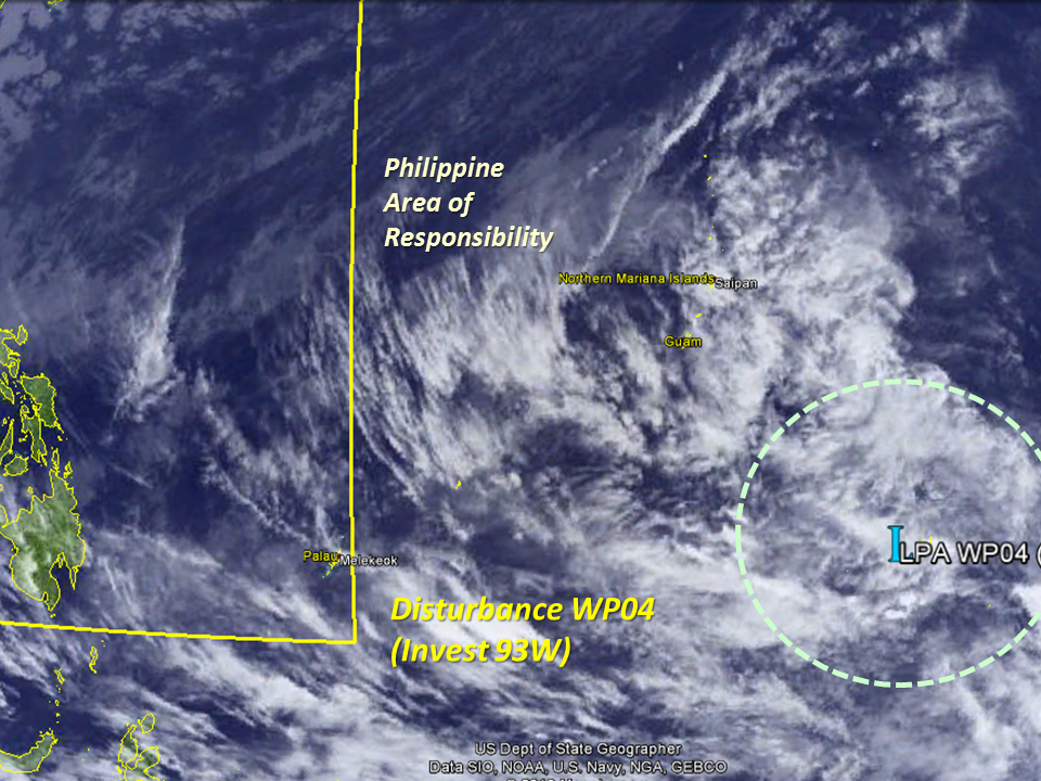 Click to enlarge Click to enlarge The main focus of this update remains the area of low pressure located near Guam and Chuuk Islands in the Pacific, namely LPA WP04 (Invest 93W)... Numerous agencies in the Pacific are still keeping watch on the system as it remains stationary over the last 24 hours.
This morning, LPA WP04 (93W) is located just near Chuuk island, about 1750 km outside of the Philippine AoR. The system remains stationary and is forecast to drift West-Northwest over the next few days, possibly drifting much closer to Yap State than to Guam in the coming days. LPA WP04 (93W) has been encountering high amounts of wind shear in the upper levels, disrupting its organization... but the shear has shown signs of relaxing in the coming days. And given the high sea temperatures, LPA WP04 (93W) may move into an area of favorable conditions next week.
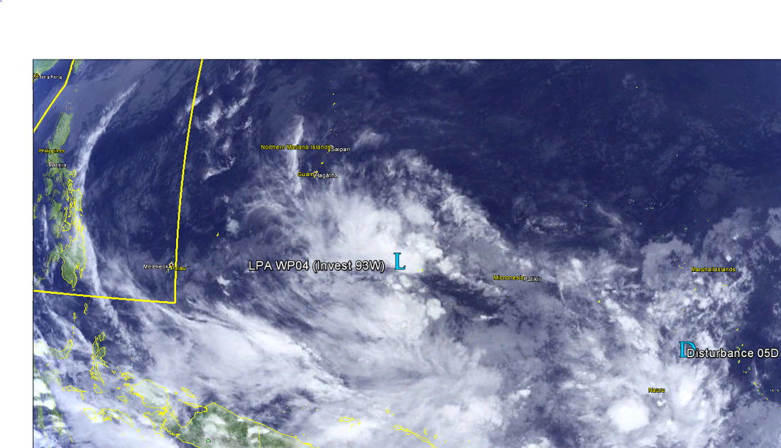
The Low Pressure Area WP03 (Invest 93W) has remained persistent around 850 km Southeast of Guam bringing showers in the Micronesian Islands. The system is considered dissipated by the JTWC in Hawaii in its last advisory, but ManilaTC still considers the system as active as most of the agencies in the region still carry the system. Meanwhile, JMA-Tokyo has mentioned in its latest advisory this afternoon that a new tropical wave/disturbance has been found south of the Marshall Islands. ManilaTC shall be designating it as 05D, as the system is still quite new. GFS remains the most bullish of the major computer models available in hinting that a tropical system to form near Guam by the end of next week perhaps going into the month of March, it remains to be seen if the other models say otherwise as well. Again we maintain that the track and chance of formation is still very much uncertain, given the long range nature of the forecast and how the models initialize the system. The potential of Disturbance WP04 to develop into a Tropical Cyclone within the next 24 hours remains at MEDIUM with 48% probability.
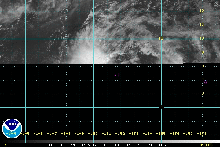
Tropical Disturbance WP04 remains disorganized over the Micronesian Islands as it drifts Northwest towards the Guam. The disturbance is currently located at 7.5°N, 151.2°E at 2pm today... Intensity has not changed much as the system remains at 15 knots (25 kph)... The disturbance is currently moving slowly in a generally NORTHWEST direction. Manila TC remains on watch as long-range forecast models are hinting at developing WP04 in the coming days. The GFS model remains the most aggressive with WP04 developing near Guam near the end of next week. The potential of Disturbance WP04 to develop into a Tropical Cyclone within the next 24 hours is at MEDIUM with 51% probability. Please take note that the track and chance of formation is still very much uncertain, given the long range nature of the forecast and how the models initialize the system.
Manila TC
A new tropical disturbance has formed south of the island of Guam, near Chuuk and is being monitored by the numerous agencies around the region.
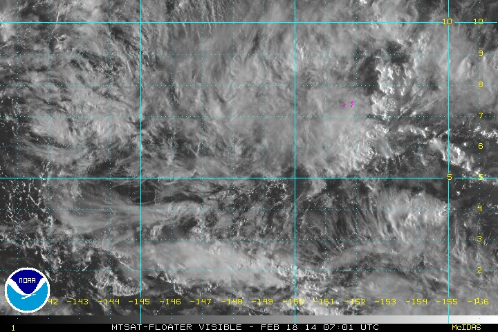
WP04 was last spotted at 5.4°N, 148.5°E at 2pm today. This is around 425 km Southwest of Chuuk or 970 km South-Southeast of Guam, USA... winds in the system were found at 25 kph (15 knots) and is drifting to the Northwest. Long-Range models have shown the system to become the next significant system in the coming days, although the track is still uncertain, owing to the long range nature of the forecast. ManilaTC shall continue to post updates regarding WP04 as the days pass. |
Archives
July 2016
AuthorThis is the official blog page of Manila Typhoon Center. All the latest advisories from ManilaTC will be coursed here should the Facebook page be inaccessible for any reason. Categories
All
|
Manila Typhoon Center - Your online resource for typhoon updates.
 RSS Feed
