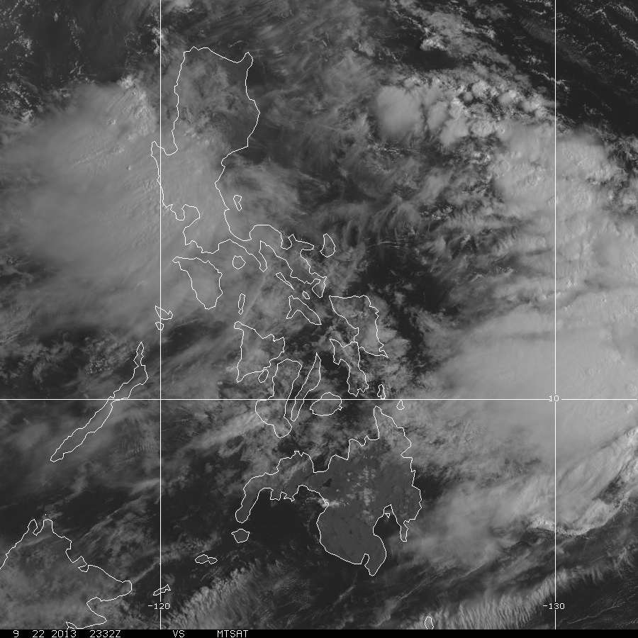
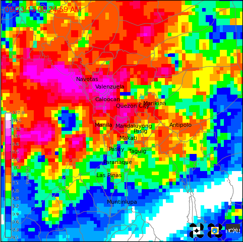
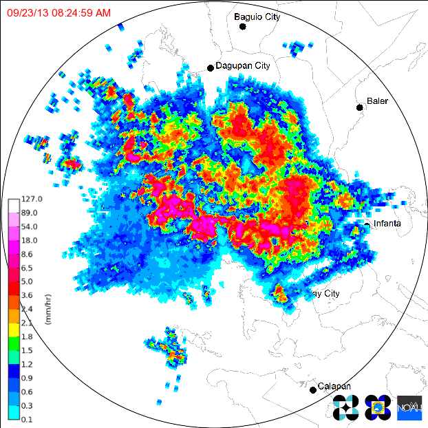
#HabagatWatch #FloodPH -- ORANGE Rain Warning remains in effect until 11:45 am Manila time9/23/2013 As of the last PAGASA Rainfall Advisory issued at 8:45 am, the ORANGE rainfall warning still remains over Metro Manila, Zambales and Bataan. These areas are being affected by heavy to at times intense rainfall and is most likely to continue for the next 3 hours.
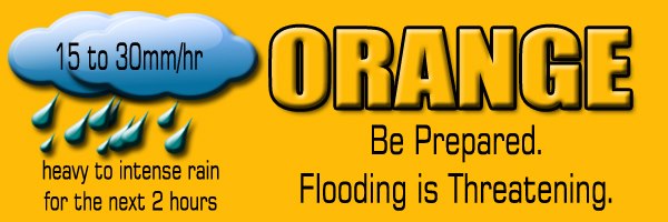
 PAGASA-DOST RAINFALL WARNINGS | 23 September 2013, Monday ORANGE RAINFALL ADVISORY No. 1 Issued at 5:45AM 23 September 2013 Moderate to occasional heavy rains affecting Metro Manila, Cavite, Batangas, Bulacan, Pampanga, Bataan, and Zambales for the next 3 hours Heavy to at times intense rainfall is affecting Metro Manila, Zambales, and Bataan and most likely to continue for the next 3 hours. However, moderate to heavy rains affecting Rizal, Bulacan, Pampanga and portions of Laguna, Quezon, Cavite, and Occidental Mindoro which may persist within 3 hours.
Here is a list of Class suspensions, as of posting time
Metro Manila
As of the latest rainfall warnings posted by PAGASA around 12:05 pm today, Metro Manila and its surrounding provinces REMAIN under a YELLOW Rainfall Warning, and shall persist for the next three hours -- Manila TC 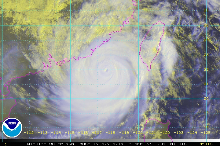 The strongest tropical cyclone on the planet for this year (so far, we still have 4 months) has weakened into a Category 3 Typhoon after undergoing a EWRC (Eyewall replacement cycle). Latest data shows that the Typhoon is reintensifying after retaining an Eye.
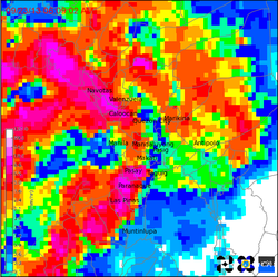
For a full explanation of a EWRC, see this Wikipedia article. Click Here. USAGI has also left the Philippine AoR last night, after making landfall over Itbayat Island in the Batanes Island Group as a Category 5 Super Typhoon. It was the strongest typhoon to hit Batanes (as typhoon-prone as they are) since 1987. USAGI (Odette) is now headed for a collision course with Hong Kong as of the moment. More info at the jump, so click Read More. 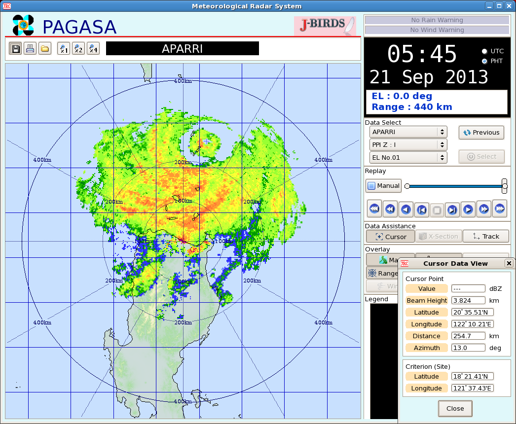 The radar image on the right shows the Eye of Super Typhoon ODETTE (Usagi) causing a direct hit on the Islands of Batanes around 5-6 am Manila Time.
At 6 am today Manila time, The eye of Super Typhoon ODETTE (Usagi) was last located at the vicinity of the Batanes Group of Islands or at 20.5°N, 122.2°E... 240 km North-Northeast of Aparri, Cagayan... ODETTE (Usagi) is moving on a WEST-NORTHWEST TRACK at 20 kph. Image courtesy of PAGASA Northern Luzon - Aparri Radar. More at the jump, so click READ MORE!  Click to view satellite loop animation! Click to view satellite loop animation! PAGASA-Manila (finally - Ed.) has followed suit on its latest bulletin ramping up Super Typhoon ODETTE (Usagi) and prompted the raising of Typhoon Warning Signal Number 4.
PAGASA TYPHOON WARNING SIGNALS (as of 11 am Warning) SIGNAL NUMBER 4 -- Batanes Group of Islands... meaning winds exceeding 185 kph are expected in at least the next 12 hours SIGNAL NUMBER 3 -- Calayan Group of Islands and Babuyan Group of Islands... meaning winds from 101 to 185 kph SIGNAL NUMBER 2 -- Cagayan, Ilocos Norte, and Apayao... meaning winds of 61-100 kph are expected in the next 24 hours SIGNAL NUMBER 1 -- Abra, Kalinga, Isabela, Northern Aurora, Quirino, Nueva Vizcaya, Benguet, La Union, Ilocos Sur, Mt. Province, and Ifugao... meaning winds of 45-60 kph are expected in the next 36 hours At 11 am today Manila time, The eye of Super Typhoon ODETTE (Usagi) was last located at 19.5°N, 124.9°E... 330 km East Northeast of Aparri, Cagayan or at 340 km East of Calayan Island, Cagayan... fix based on the ADT fixes... ODETTE (Usagi) is moving on a NORTHWEST TRACK at 18 kph. INTENSITY ESTIMATES BY WEATHER AGENCIES PAGASA-Manila -- Max 205 kph Gust 240 kph (10 min-average) CMA-Beijing -- Max 220 kph Gust 265 kph (10 min-average) JMA-Tokyo -- Max 205 kph Gust 270 kph (10 min-average) KMA-Seoul -- Max 195 kph Gust 235 kph (10 min-average) JTWC-Hawaii -- Max 260 kph Gust 315 kph (1 min-average) CWB-Taiwan -- Max 200 kph Gust 240 kph (10 min-average) HKO-Hongkong -- Max 195 kph Gust 210 kph (10 min-average) #ManilaTC #TyphoonWatch #SuperTyphoon #OdettePH #UsagiWP #HabagatWatch 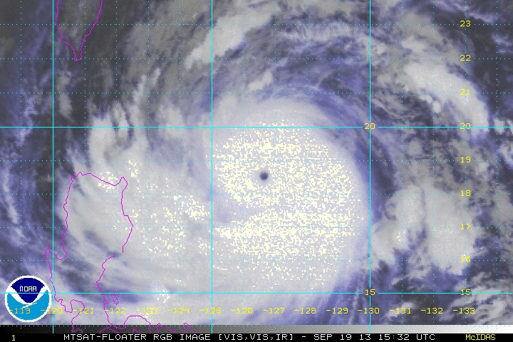 Click on image for animated loop Click on image for animated loop ODETTE (Usagi) has been given the SUPER TYPHOON title by JTWC-Hawaii and CMA-Beijing. The howler has now winds reaching 230 kph, a Strong Category-4 Typhoon on the Saffir-Sampson Scale. The Super Typhoon is now making its approach towards extreme Northern Luzon and Southern Taiwan, then go on its way towards Southern China-Hongkong area.
PAGASA TYPHOON WARNING SIGNALS (as of 5 am Warning) SIGNAL NUMBER 3 -- Batanes Group of Islands... meaning winds of 101-185 kph are expected in at least 18 hours SIGNAL NUMBER 2 -- Cagayan, Calayan and Babuyan Group of Islands, Apayao... meaning winds of 61-100 kph are expected in the next 24 hours SIGNAL NUMBER 1 -- Ilocos Norte, Ilocos Sur, Mt. Province, Ifugao, Abra, Kalinga, Isabela ... meaning winds of 45-60 kph are expected in the next 36 hours At 6 am today Manila time, The eye of ODETTE (Usagi) was last located at 19.1°N, 125.8°E... about 445 km East-Northeast of Aparri, Cagayan or 430 km East-Southeast of the Batanes Island Group... fix based on the ADT fixes... ODETTE (Usagi) is moving on a steady WEST-NORTHWEST to NORTHWEST TRACK at 20 kph INTENSITY ESTIMATES BY WEATHER AGENCIES PAGASA-Manila -- Max 175 kph Gust 210 kph (10 min-average) CMA-Beijing -- Max 220 kph Gust 265 kph (10 min-average) JMA-Tokyo -- Max 205 kph Gust 270 kph (10 min-average) KMA-Seoul -- Max 195 kph Gust 235 kph (10 min-average) JTWC-Hawaii -- Max 260 kph Gust 315 kph (1 min-average) CWB-Taiwan -- Max 200 kph Gust 240 kph (10 min-average) HKO-Hongkong -- Max 195 kph Gust 210 kph (10 min-average) *** PAGASA remains to be the lowest intensity among all the West Pacific agencies, and appears to avoid classifying storms above 185kph, its Signal 4 threshold. They keep underestimating. - Manila TC admin *** More info at the jump, so Click Read More. 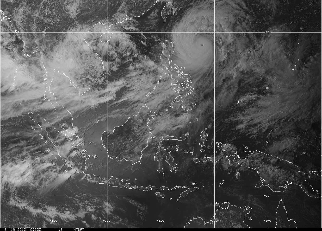 Time and time again, the waters of the Philippine Sea have generated several major Typhoons due to its warm Sea Surface Temperatures (SST's).
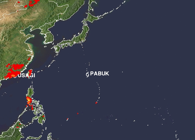
Looks like ODETTE (Usagi) will be no exception. More at the jump. Click "Read More"... 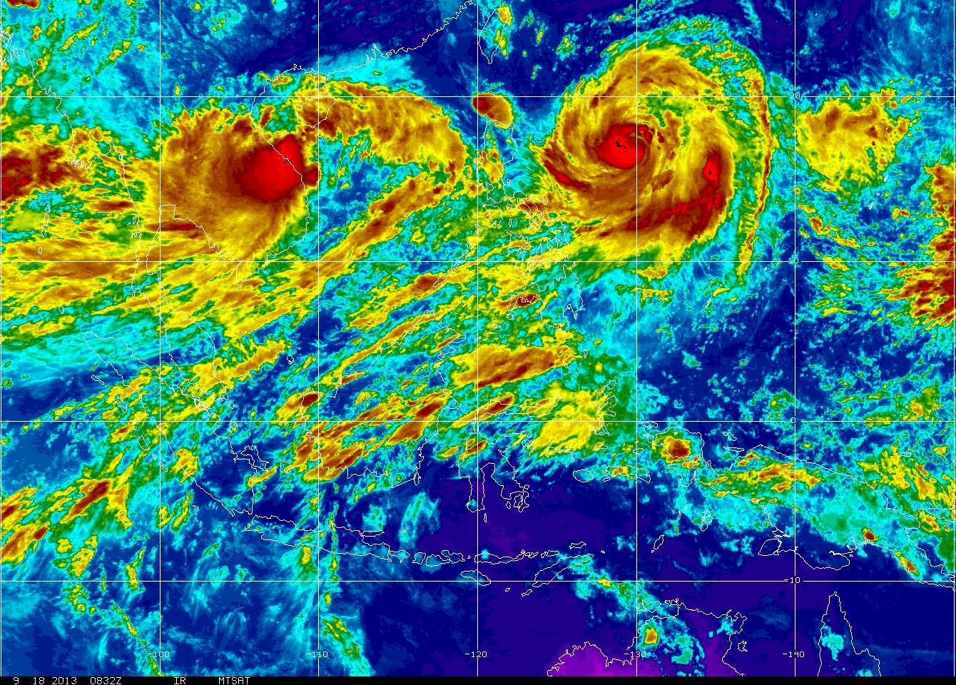 We now have two tropical cyclones in the Western Pacific, Severe Tropical Storm ODETTE (Usagi) barely moving east of Northern Luzon, and Tropical Depression TC31/18W in the South China Sea.
A third disturbance is currently still persisting East of Guam and is also being monitored. More at the jump, so Click Read More :) 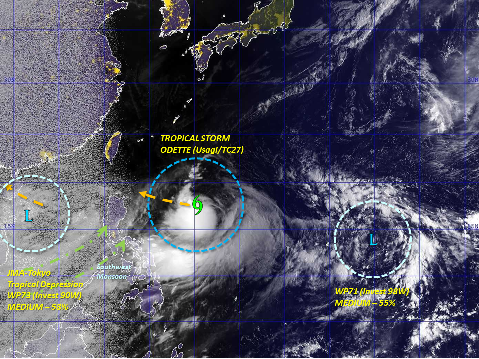 Tropical Weather Outlook by Manila TC Tropical Weather Outlook by Manila TC Sorry we have been gone for a while, and we are back!
ManilaTC admin has been dealing with some relocation issues lately and we would like to express our apologies to our ardent site followers. Now that TC29/Man-Yi has become an Extratropical Low over the Japanese Islands, we now put our attention to Tropical Storm Odette (Usagi) threatening the Northern parts of the Philippines. Meanwhile, a JMA Tropical Depression west of Vietnam and another Disturbance near Guam is also being tracked by Manila TC. More at the jump so click on Read More. |
Archives
July 2016
AuthorThis is the official blog page of Manila Typhoon Center. All the latest advisories from ManilaTC will be coursed here should the Facebook page be inaccessible for any reason. Categories
All
|
Manila Typhoon Center - Your online resource for typhoon updates.


 RSS Feed
